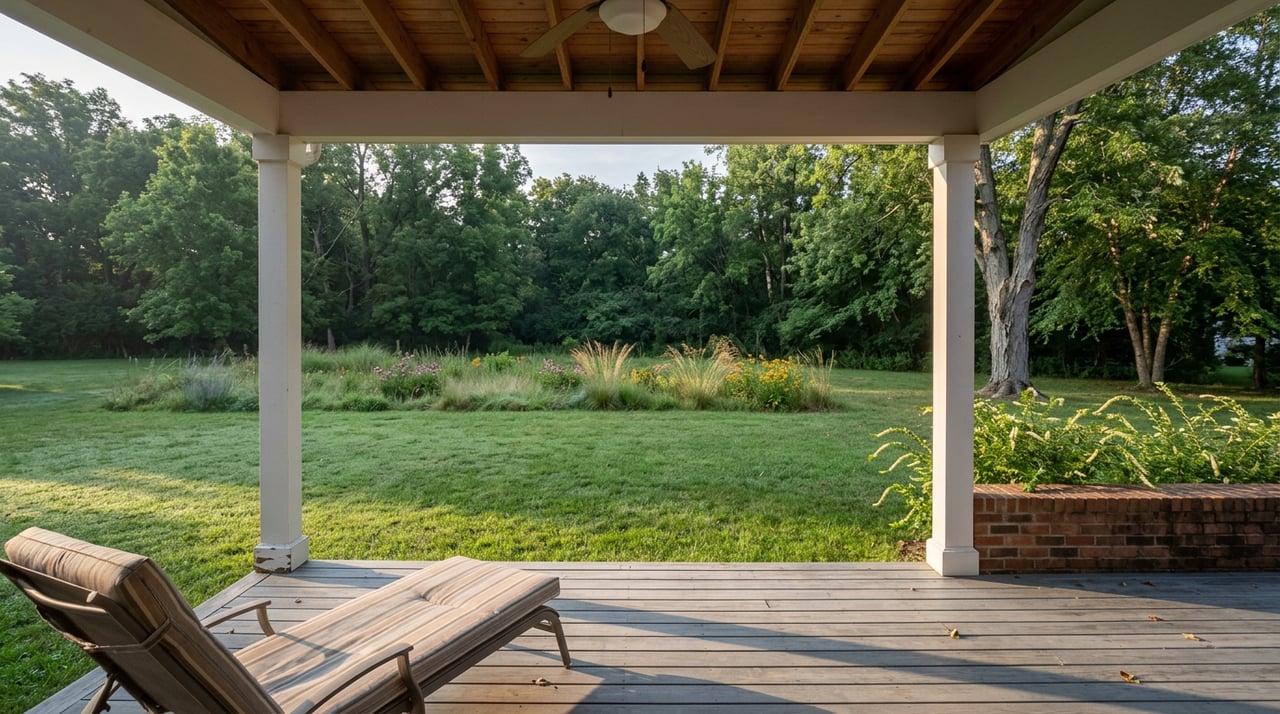
Lake in the Hills Fen Nature Preserve Explained
August 13, 2026
August 13, 2026
Ask a neighbor how big the Fen off Pyott Road actually is and you'll probably get a shrug, or a number half-remembered from a sign at Barbara Key Park. Ask the agencies that manage it and you'll get four different answers, all in acres, all supposedly describing the same stretch of gravel prairie and wetland a few blocks from Sunset Park's ball fields.
The Village of Lake in the Hills' own facility page calls the Fen a "260-acre nature preserve" in one sentence, then a few lines down refers to "the 240-acre Fen at Barbara Key Park" as the village's largest natural resource, on that same page. The McHenry County Conservation District, which handles the trail maintenance and mowing, puts the combined complex at 436 acres. Openlands, the regional conservation nonprofit that helped protect the land, rounds up to nearly 500. None of these numbers is wrong exactly. They're measuring different things, and figuring out why tells you something real about how this piece of town actually works.
According to the McHenry County Conservation District, the Lake-In-The-Hills Fen Conservation Area itself covers 229 acres. Sitting directly next to it is a 207-acre parcel that carries a different designation entirely, a State Nature Preserve co-owned by the Village of Lake in the Hills and the Illinois Department of Natural Resources. Add those two figures together and you land close to the 436-acre number MCCD uses for the whole complex.
The Village's own 240-acre figure appears to track only the piece it manages directly rather than the adjoining IDNR co-owned tract next door, which would explain why its 260-acre reference two sentences earlier doesn't match. Openlands' "nearly 500" likely rounds in the other direction, folding in buffer land and marsh that doesn't sit on any single deed.
None of this is a clerical mistake. It's what happens when a state agency, a county conservation district, and a village government all have a legitimate claim to different slices of the same wetland. For anyone actually walking out there, it means the answer to "how much protected land am I standing on" depends on which trailhead you used and whose sign you're reading.
The reason three different governments bothered to carve up ownership here at all comes down to what's underneath the prairie grass. The Fen sits on morainal ridges left by glaciers, mostly limestone gravel, where groundwater picks up minerals as it filters down and seeps back out at the base of the hills to form what's called a hanging fen. The IDNR counts nine distinct native plant communities inside the preserve, from dry gravel prairie and calcareous seeps to sedge meadows that grade into cattail marsh along Crystal Creek.
The plant list reads like a rare-species inventory: Hill's thistle, prairie smoke, prairie gentian, leadplant, and the false asphodel all grow in a preserve the Village says holds more than 400 native plant species, more than 40 of them classified as uncommon, rare, or endangered statewide.
The Illinois Department of Natural Resources describes the fen as home to what it calls the tiny blue bell, the state's smallest damselfly, known to survive in only two sites in Illinois.
The sedge meadows closer to the creek support Baltimore checkerspot butterflies and a run of wetland birds that never turn up near Sunset Park's ball fields, including sora rails, yellow-headed blackbirds, marsh wrens, and common snipe. The Village counts more than 60 bird species using the preserve across the year.
There are three distinct routes through the preserve, and trail reviewers on AllTrails have logged enough visits to show a pattern most first-timers get backward.
The instinct for a first visit is to pick the loop with the bigger number, assuming more distance means more to see. Here it runs the other way. The Large Loop, the shorter and easier of the two, is also the one where you can bring a leashed dog and the one locals favor through the warm months. The East Loop, longer and rated harder, is dog-free and comes into its own once temperatures drop and the sedge meadows turn gold into early winter.
The timing matters more than it looks. The Lake in the Hills Rotary Club just wrapped its 20th anniversary Rockin' Ribfest at Sunset Park, running July 9 through 12 with a carnival, a business expo, and a full slate of BBQ vendors. Labor Day weekend brings the Summer Sunset Festival back to the same park, September 4 through 6, with the Windy City Amusements midway running late into both evenings.
Both events sit a short drive from the Fen's Pyott Road access point. While Sunset Park fills with carnival lights and amplified bands, trail reviewers consistently describe the Fen the same way regardless of season: unlikely to encounter many other people. That's true in the dead of winter and it appears to hold just as well the same weekend the rest of the village is standing in a ribfest line two minutes away. If the crowd at Sunset Park isn't your idea of a good Saturday, the quieter half of your own town is sitting right behind it, and it doesn't get any louder just because the calendar says festival weekend.
Lake in the Hills didn't start as a planned suburb. According to the Village's own economic development page, it grew up around Woods Creek Lake as a cluster of summer cottages that gradually became year-round homes, with subdivisions filling in to the west through the building boom of the 1990s and early 2000s, some of them built around the Boulder Ridge Golf Course and Country Club. The Fen and the Prairie Trail regional path predate most of that growth by thousands of years, tucked against the edges of newer development rather than built to complement it.
That layering, a lake town that grew a golf course community on one side and left an ancient wetland mostly alone on the other, is part of what makes the acreage confusion make sense. Nobody sat down and designed this place as a single coherent park system. It accumulated, parcel by parcel, agency by agency, and the paperwork never fully caught up to the fence lines.
Knowing that kind of detail, not just what a place looks like on a listing photo but how its land actually got divided up and why the numbers on two different signs don't match, is the same instinct that matters when you're evaluating any property here, whether it's a starter home near Woods Creek Lake or a parcel that borders conservation land. Swanson Real Estate, Inc. has spent decades paying attention to exactly this kind of local detail across the Fox Valley, and we're always glad to talk through what a specific address or parcel actually means once you look past the number on the sign. Contact us anytime you're ready to dig into the details of a property here.
Stay up to date on the latest real estate trends.
We pride ourselves in providing personalized solutions that bring our clients closer to their dream properties and enhance their long-term wealth.